Where does the Blue Ridge Parkway start and end?
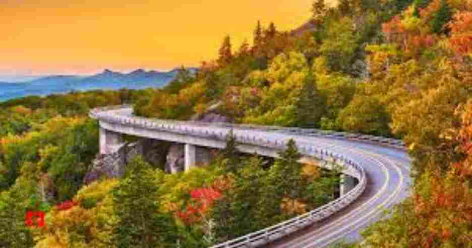
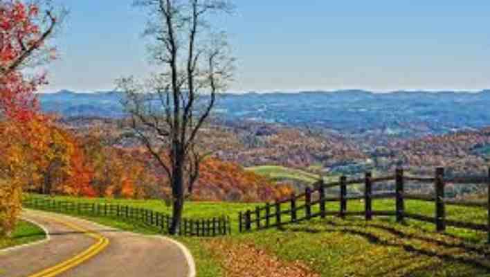
The Blue Ridge Parkway is an awesome, charming trip that will leave you speechless as it passes through the gorgeous Appalachian Mountains. It’s one of those amazing road trips that truly live up to its reputation, whether you’re a hiker, photographer, or just want to drive along those bending mountain roads.
Beginning near Waynesboro, Virginia, the Blue Ridge Parkway travels 469 miles over the highlands to Cherokee, North Carolina. Grandfather Mountain, Linville Falls, Mount Mitchell, and the Linn Cove Viaduct are some breathtaking sites along the way.
The stunning Blue Ridge Parkway, sometimes called “America’s Favourite Drive,” is a perfect place to slow down off the interstate and stop to take in the surrounding natural beauty.
Where is Blue Ridge Parkway situated and where does it start and end?
On the east border of the United States, the Blue Ridge Parkway passes through the states of North Carolina and Virginia. It’s a 469-mile beautiful highway that winds through the Appalachian Blue Ridge Mountains.
This road runs from north to south if you follow the mileposts in that order, but you may follow this lovely route in either direction of course.
The route starts just outside Shenandoah National Park, close to Waynesboro, and continues south through Rockfish Gap, Virginia.
Cherokee, North Carolina, which is near the Great Smoky Mountains National Park is accessible by the road.
Simply choose the best route from wherever you are beginning if you are going the entire distance. Depending on your future travel plans more than anything else, you can decide to head north or south if you’re joining the route halfway.
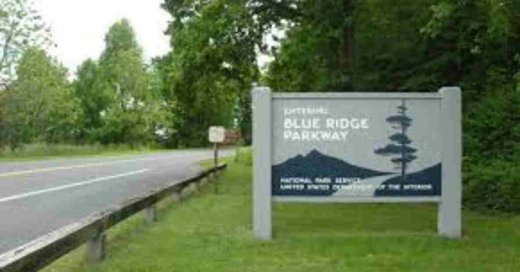
The Blue Ridge Parkway’s entrance
Just outside of Waynesboro, Virginia, the Blue Ridge Parkway starts. If you’re traveling further, you can also access the parkway from I-64.
If you have the time, you may easily combine the two beautiful roads into a single journey because the road continues straight from Skyline Drive through Shenandoah National Park.
Although you will pass through several towns and communities along the way, the Blue Ridge Parkway is mainly a scenic journey over the endless mountain surroundings.
About three hours into the trip (115 miles), Roanoke is the first city you will see along the Parkway. Roanoke is a great place to stop off because it’s around an hour north/northwest of the stunning Smith Mountain Lake.
To gain a better sense of the area, visit the Art & History Museum and the well-known Mill Mountain Star.
The magnificent Biltmore Estate in Asheville, which you will reach near the end of your drive, is worth seeing. To learn more about the locations you saw during your journey, you may also make a stop at the Blue Ridge Parkway Visitor Center here.
The Blue Ridge Parkway’s endpoint
On the edge of Great Smoky Mountains National Park, the Blue Ridge Parkway ends at its junction with US-441. Just a few miles down the highway is Cherokee, the closest town.
The Cherokee Indian Museum, which celebrates the history and culture of the area’s indigenous people, is a great place to spend some time.
The Great Smoky Mountains National Park is another option if you want to spend more time in nature. You can choose to walk at one of the trailheads along the way, or you can enjoy a beautiful drive across the national park on Route 441 towards Gatlinburg and Pigeon Forge.
The route can be easily linked to a longer road trip because the southern end is only 45 minutes from I-40.
Has Blue Ridge Parkway undergone any changes?
Between the 1930s and the 1980s, the Blue Ridge Parkway was constructed. It was always meant to connect the Great Smoky Mountains National Park in North Carolina and Tennessee with Virginia’s Skyline Drive ( what is now Shenandoah National Park).
Since the parkway’s evolution was influenced by its beginning and finishing places, they were always included in the design. however, there is an argument on the path of the road and design.
Both North Carolina and Tennessee voiced the event that their states would be crossed by the new road. North Carolina won the debate, which helped Asheville’s economy recover from the Great Depression.
The entire BRP wasn’t driveable for more than 50 years. The pace of progress was slow.
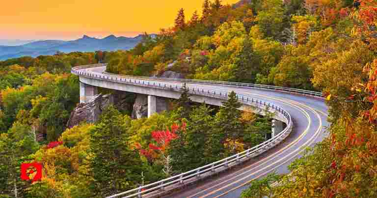
The construction of the Linn Cove Viaduct, the final significant development, required careful planning to prevent environmental harm. In 1987, the route was eventually completed.
Where do I start my road trip to Blue Ridge Parkway?
The majority of people plan their Blue Ridge Parkway road trip on the city from where they begin the journey. You’ll probably be aware whether the northern or southern end of the parkway is a more helpful place to start if you’re starting nearby.
The Blue Ridge Parkway’s close to the interstate system makes it easier to connect from cities further away, which is a great benefit.
Along the way, you may join the Blue Ridge Parkway. You can pick up the road at locations like Roanoke, Meadows of Dan, Fancy Gap, Blowing Rock, Grandfather Mountain, Asheville, or Bent Creek if you don’t have time to drive the entire parkway because there are entrances and exits all along it.
Traveling along the Blue Ridge Parkway on the outgoing leg of your journey or on your way home is completely up to personal preference, but if you’re driving the parkway as part of a round trip, you’ll likely use the interstate either way.
We’ve added the driving times and distances from the area’s largest cities to both ends of the Blue Ridge Parkway to assist you in choosing which way to go.
| Starting city | Distance/time from the start | Distance/time from the end |
| Richmond, VA | 90 miles/1 hour 25 minutes | 420 miles/6 hours 30 minutes |
| Washington, DC | 140 miles/2 hours 40 minutes | 530 miles/8 hours |
| Raleigh, NC | 205 miles/3 hours 40 minutes | 300 miles/4 hours 45 minutes |
| Charlotte, NC | 265 miles/4 hours 15 minutes | 165 miles/3 hours |
| Pittsburgh, PA | 295 miles/4 hours 45 minutes | 525 miles/8 hours 30 minutes |
| Asheville, NC | 330 miles/5 hours | 0 miles/1 hour |
| Knoxville, TN | 345 miles/5 hours | 75 miles/2 hours |
| New York, NY | 400 miles/6 hours 25 minutes | 750 miles/11 hours 50 minutes |
| Louisville, KY | 470 miles/7 hours | 315 miles/6 hours |
| Charleston, SC | 485 miles/7 hours 15 minutes | 300 miles/5 hours |
| Atlanta, GA | 520 miles/7 hours 20 minutes | 160 miles/2 hours 50 minutes |
| Nashville, TN | 520 miles/7 hours 40 minutes | 250 miles/4 hours 40 minutes |
How long does it take to drive on Blue Ridge Parkway?
Despite a 45-mph speed limit, driving the entire Blue Ridge Parkway takes up to 11 hours. Allow an additional three hours for the trip considering slower-moving cars may produce tailbacks during peak hours.
To travel the trip at a reasonable pace, we recommend allowing at least three days. This allows you to climb to some of the breathtaking vantage points that are located far from the road and to stop for a meal.
If you want to hike for a longer period, you could easily spend a week exploring the many lovely trails, especially if you’re going on some of the longer ones.
Anywhere along the BRP, there are pockets of slower traffic, whether it’s due to a car ahead slowing down to take in the scenery or someone simply taking their time around the route’s several curves.
Congestion may also be present while approaching well-known spots, particularly if cars are waiting to park at lookouts.
With holiday weekends, summer, and the fall leaf-peeping season bringing many more tourists, traffic peaks seasonally. Avoiding these times increases the likelihood that your trip will go smoothly.
likewise need to include frequent rest periods. If you intend to drive straight through, you should allow three to five stops to stretch your legs, but most people will want to stop occasionally to take in the sights. Your drive will take an additional hour or two as a result.
Factors that might impact driving time
Our top tip for driving the Blue Ridge Parkway in a short period is as listed below:
- To give everyone a chance to take in the scenery while driving, take turns behind the wheel.
- Avoid exiting the parkway too frequently for gas use an inexpensive car.
- Drive in the middle of the week, when traffic is probably going to be less.
- Before the route becomes congested, get started early in the morning. If you want to avoid leaving the Blue Ridge Parkway, get supplies and bring some food along with snacks.
Blue Ridge Parkway attractions and charming spots
Mile after mile of stunning views can be seen along the Blue Ridge Parkway, as you might expect. The best part about this journey is that you may stop whenever you want to take in the scenery.
These are some of the more well-known beautiful paths and overlooks to keep an eye out for, though there are many more. It’s advisable to start early if you plan to visit any of these on a busy weekend to ensure that there will be parking available when you arrive.
- Ravens Roost (MP 10.7) –Watch the sun set over a magnificent valley from this amazing spot close to the parkway’s northern entrance.
- Otter Lake Overlook (MP 63.1) –At this lovely lake, relax near the water.
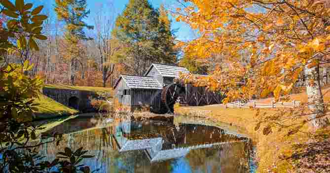
- Mabry Mill (MP 176.1) –As you will understand when you see the peaceful scene for yourself, taking a picture of this historical watermill is truly amazing at Blue Ridge Parkway
- Cascade Falls (MP 272) –It’s a short walk off the trail to these amazing falls.
- Rough Ridge (MP 302.8) – This climb at Blowing Rock offers the best cliff-edge views if you’re comfortable with heights; make sure to take a picture to remember the experience.
- Beacon Heights Overlook (MP 305.2) –From this vantage point take in three of the parkway’s famous views: Table Rock, Grandfather Mountain, and Grandmother Mountain.
- Linn Cove Viaduct (MP 304)-This was the parkway’s last completed part, In the 1980s, it linked the northern and southern sections of the road, passing Grandfather Mountain.
- Linville Falls (MP 316) –There are more magnificent waterfalls that make the walk from the road rewarding.
- Cheston View Overlook (MP 320.7) –For a breathtaking view of Grandfather Mountain and Pisgah National Forest, take a short walk out to this vantage point.
- Mount Mitchell (MP 355) –Nearly all of the way to the top of this alpine overlook is accessible by car.
Frequently Asked Questions
What is the end of the Blue Ridge Parkway?
The Blue Ridge Parkway ends at the Great Smoky Mountains National Park in North Carolina. Specifically, it terminates at the junction with U.S. Route 441 near the town of Cherokee.
Where is the prettiest part of Blue Ridge Parkway?
One of the prettiest parts of the Blue Ridge Parkway is the stretch between Peaks of Otter and Mabry Mill, offering stunning mountain views, wildflower fields, and historic sites. The section around Linville Gorge is also particularly scenic, with dramatic cliffs and waterfalls.
Which direction is best to drive the Blue Ridge Parkway?
Driving the Blue Ridge Parkway from south to north offers the best views, with the sun behind you and scenic overlooks.
How many states does the Blue Ridge Parkway go through?
The Blue Ridge Parkway stretches through two states: North Carolina and Virginia. It runs for 469 miles, connecting the Great Smoky Mountains to Shenandoah National Park.
What month is best for Blue Ridge Parkway?
The best month to visit the Blue Ridge Parkway is October when the fall foliage is at its peak.
How long does it take to drive the Blue Ridge Parkway from Cherokee to Asheville?
It takes about 2 to 2.5 hours to drive the Blue Ridge Parkway from Cherokee to Asheville, covering around 60 miles.
For more information on Blue Ridge Parkway kindly visit http://www.blueridgeparkway.org
